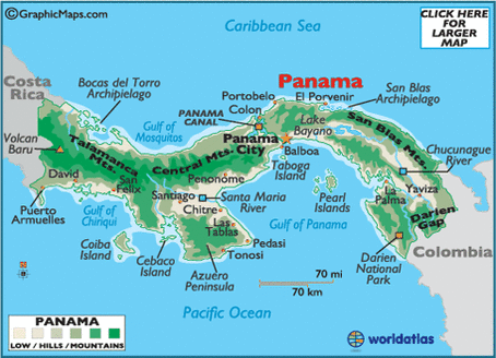
The picture below is a map of panama & its land map.
Key:
White: low areas
Gray/light green: hills
Dark green: Mountains
Key:
White: low areas
Gray/light green: hills
Dark green: Mountains
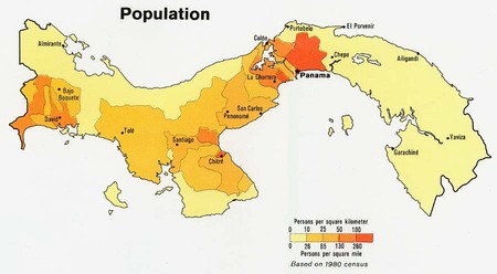
This map is a map of Panamas population. The map is person per square mile.
Key:
Light yellow: 0-25
Yellow orange: 25-85
Light orange:85-130
Orange:130-260
Dark orange:260+
Key:
Light yellow: 0-25
Yellow orange: 25-85
Light orange:85-130
Orange:130-260
Dark orange:260+
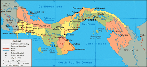
This is a map of Panama & its major, cites, provinces, international boundary's, roads, rivers, & more.
Key:
Golden lines: International boundary's
Gray lines: Province boundary's
Red lines: Roads
Blue lines: Rivers
Stars: National capitals
Big Circles: Province Capitals
Little Circles: City or Town
Key: 1-inch equals 25 miles.
Key:
Golden lines: International boundary's
Gray lines: Province boundary's
Red lines: Roads
Blue lines: Rivers
Stars: National capitals
Big Circles: Province Capitals
Little Circles: City or Town
Key: 1-inch equals 25 miles.
